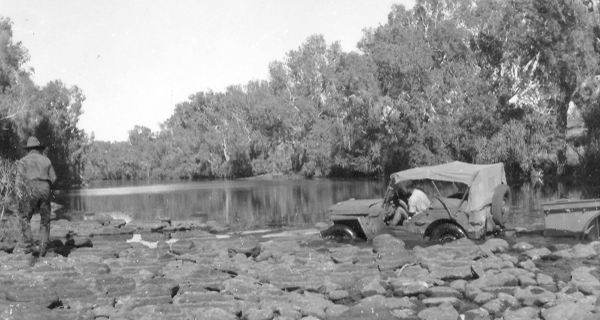
Figure 7. Jeep and trailer crossing the Bluey Creek
en route to Calvert Hills H.S., 1949.
| Communications
After having only a wireless receiver during 1948, a portable transceiver built by the Radio Section, Department of the Interior was provided in 1949. The call sign allotted was 8ZI (Zebra Item) and the purpose of the set was to: The departmental wireless set was not satisfactory and during 1950-52 the AWA, 3BZ Teleradio transmitter and receiver were used with varying results due to weather conditions and valve, vibrator and circuit breakdowns caused by rough travelling conditions. Still it was reassuring when working in isolated areas to know that contact could be made with the FDS, if not always directly then through the nearest homestead Traeger pedal wireless set. Figure 10. During 1951-52, four portable radios were in use, one to each observing party with call signs - 8ZH, 8Z1, 9JT and 9JV. 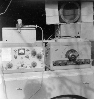 Figure 10. The AWA 3BZ teleradio transceiver |
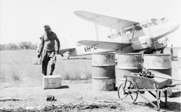
Special mention should he made of the Flying Doctor base operators at that time, namely Graham Pitts, 8US Alice Springs, Vernon Kerr, VJI Cloncurry, Fred Rile, 851 Wyndham and Frank Basden, 8SK Broken Hill who were very patient and considerate when listening out for the weaker portable radio transmitters. The difference in communications between those days and now is particularly striking. I am not sure it is always for the better, as there was a lot in favour of only getting the occasional letter or telegram from the office during a six month field season compared with the current trend of day to day telephone calls between office and field. Another important form of communication in Northern Australia was provided by Connellan Airways based at Alice Springs and much of our mail and supplies came on Connellan's aircraft, not only spare parts for the radio and vehicles but also fresh fruit and vegetables. Figure 11. Summary During the 1948-52 period, 480 astrofixes were observed primarily to provide planimetric control for 78 x 1:250 000 maps covering an area of approximately 1.3 million square kilometres. See Figure 12. Some of these astrofixes were used in the preparation of Aerodrome Approach Charts for Oodnadatta, Leigh Creek and Longreach. The Oodnadatta work was done using the old Trimetrogon aerial photographs. In addition a few sheets of one mile to one inch mapping were required in the Tennant Creek and Harts Range areas of the N.T. by the Bureau of Mineral Resources. Astrofixes were used to control this mapping together with photo-identified points of the local trigometric network and the Stuart Highway traverse station points in the Tennant Creek area. The main purpose of the astrofixes was to control assemblies of slotted templates which provided photogrammetric control for plotting planimetric detail on map compilation sheets for the R502 map series. Although adequately recorded, this aspect of mapping by Natmap has not been published. Also during the 1948-52 period, about 4500 barometer spot heights were obtained and thousands of aerial photographs were annotated with map detail in the field to assist with the photo interpretation during compilation of the maps in the office. |